
Chicago: The Garden City Revisited | 2020
Geographic Information Systems for Planning and Policy

Skills:
data analysis | team collaboration | project management | research | design | presentation

Tools:
ArcGIS | Microsoft Excel | Adobe Illustrator | Chicago Data Portal
Description:
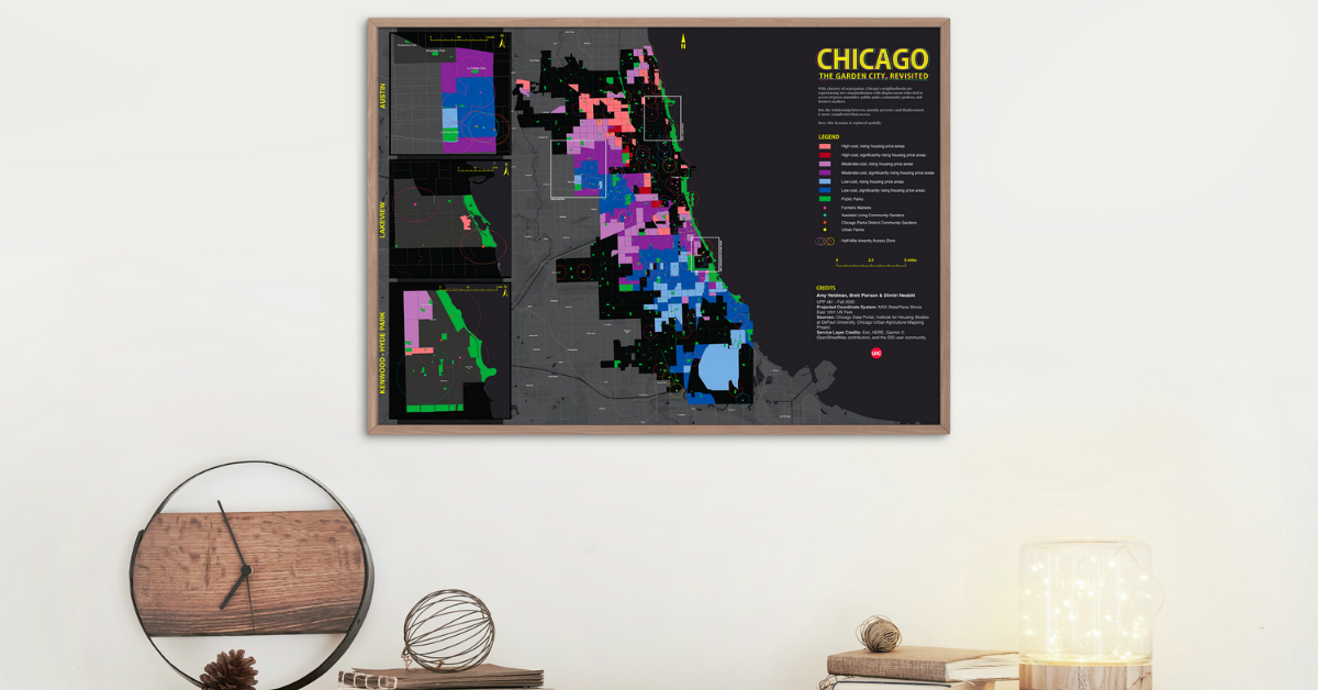
The project displayed the spatial relationship between “green amenities” of public parks, farmers markets, urban farms, and assisted living community gardens and Chicago community areas experiencing levels of displacement and marginalization. The map is the culmination of a quantitative-to-qualitative process from citywide patterns to case studies in Austin, Hyde Park-Kenwood, and Lake View neighborhoods. The work is an exercise in Geographic Information Systems, using original and recreated data translated into visual layers.
Responsibilities:
- Lead a small team on GIS data acquisition and visualization, including framing the primary research question on spatial relationships of green amenities and displacement.
- Singularly geocoded all datasets and recreated data on housing displacement from DePaul University.
- Fully deployed ArcGIS skills like data preparation, geocoding, merging and buffering, and intelligent color, credit, and label hierarchies.
- Enhanced map within Adobe Illustrator to create visual appeal, stylized production, and editorial quality.
Explore this map (click to enlarge):
Final Map Impression
