
Mapping Engineered Conflict | 2021
Urban Data Visualization Lab

Skills:
research | design | presentation | team collaboration

Tools:
Microsoft Excel | Chicago Data Portal | ArcMap | Adobe Illustrator
Description:
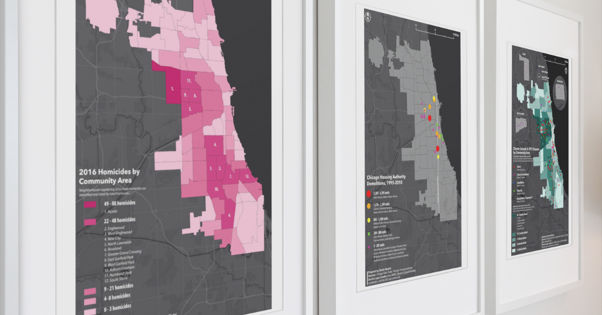
Completed through a special research assistantship, the series of maps describe the impact of Chicago’s municipal decisions that discriminatorily targeted BIPOC neighborhoods. Centered around the Plan for Transformation, six maps showing the spatiality of homicides, Chicago Public Schools closures, Chicago charter school locations, Chicago Police Department districts, Chicago Housing Authority demolitions, and an amalgamated map each contribute to the scholarship of criminology, law, and justice.
The maps were commissioned by renowned Critical Race Theory scholar Dr. David Stovall for an upcoming publication on Chicago’s engineered conflict, intersecting race and place. They required careful attention in data collection, preparation, analysis, and preparation. Disability-friendly versions of each map were submitted to the publisher.
Responsibilities:
- Collected, created, and prepared datasets on housing, crime, and education access from various Chicago governmental agencies, including successful completion of a FOIA request.
- Utilized standard map-making principles and creative map design in full-color and greyscale production for publication.
- Collaborated with the UIC Institute for Environmental Science and Policy on quality assurance, dataset visualization guidance, and client presentation.
Mapping 2016 Homicides

Mapping CHA Demolitions

Mapping Charter Schools

Mapping CPS Closures

Watch the lecture on the Chicago’s Engineered Conflict from Dr. David Stovall: